Maps Are Life. I’ve always loved cartography. It’s genetic: I grew up on a diet of yearly road trips, watching my mom sitting shotgun as the Official Navigator with her pile of AAA maps. On a high school camping trip I earned acclaim for spotting the mountain we were hiking on a terrain map while everyone else was trying to find north. My favorite memories involve me correcting the onboard GPS after realizing someone got X Avenue West and X Street North mixed up. It is now understood that on family road trips I am the Official Navigator, and I take my duties very seriously – even if I’m looking on Google Maps instead of the paper ones.
But when I started work on the Ghost Town series, I found myself with a bit of a problem.
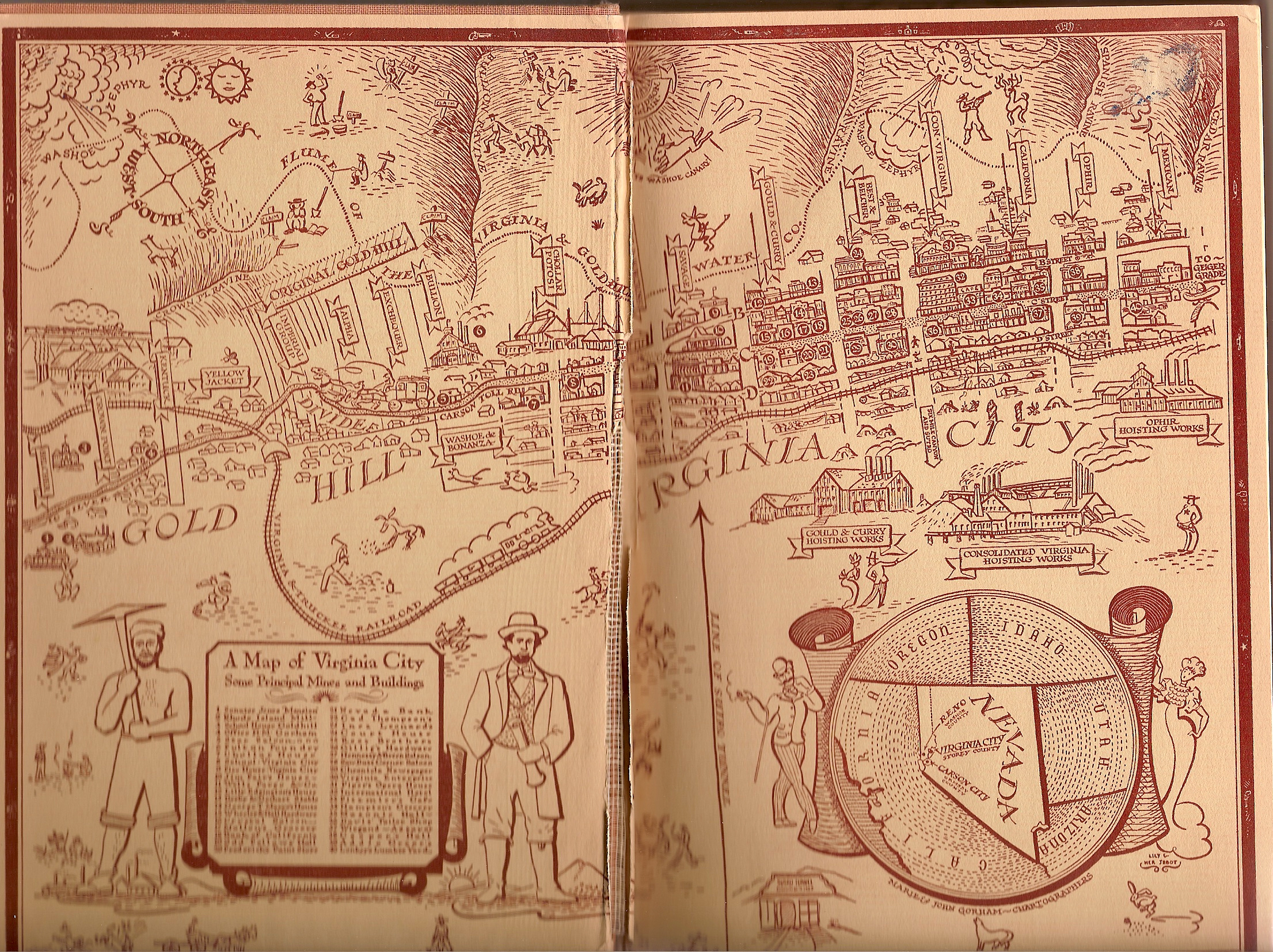
This was the first 1800s map of Virginia City I had to work with, found in a book I borrowed from obscurity at the University of Victoria library. It was utterly darling, and introduced me to several important Comstock concepts like the Washoe Zephyr and the V&T Railroad. But as the majority of the action was NOT going to be taking place in mining offices, I knew I needed something with more substance.
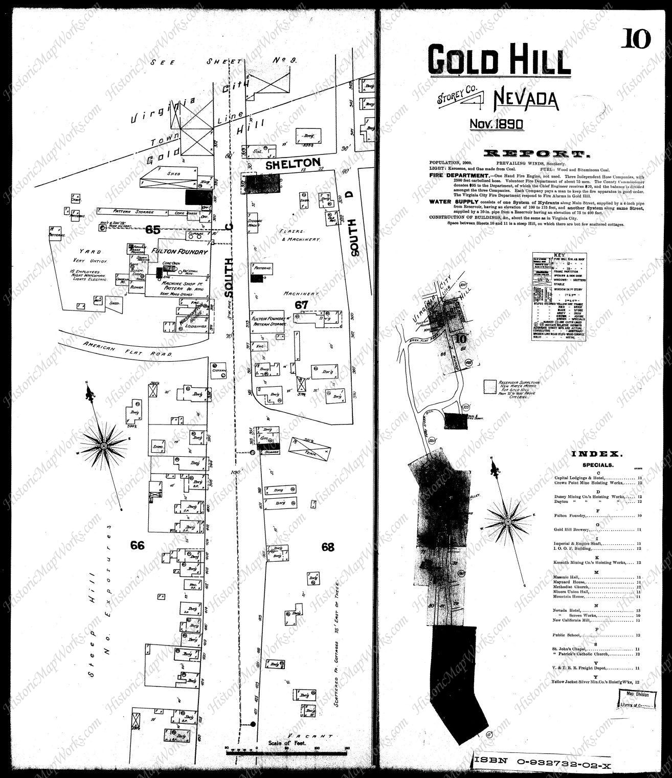
NOW we’re talking! A visit to Historic Map Works got me the survey maps of Gold Hill, and I knit them all together into my main source for all my cartographic plotting. I found out where Bill Crawford’s jail sat in relation to the Catholic church where Charlie was forced to hunt for husbands, and just how close the Yellow Jacket and Kentuck mine shafts were to the center of town. It showed me how many houses had already become abandoned, and I picked relatively uninhabited areas to insert my strictly fictional locations, like the Brennan’s Canyon Hotel and the Crown Point Livery Stables.
From there I was ready to move on to the really fun stuff: Google terrain maps!

While the mining has destroyed several topographical features over the years (RIP Crown Point Ravine), the streets of Virginia City and Gold Hill have hardly changed since the 1890s. So I generated some terrain maps and painted locations overtop.
For years this was enough for me, especially as I could not include maps in the actual novels. Working with my Frankensteinesque collection was more than enough to plot and scheme. But as I got deeper and deeper into the rabbit hole of Photoshop cartography, mapping out my new world of Bifrons, I knew I had to return to Gold Hill.
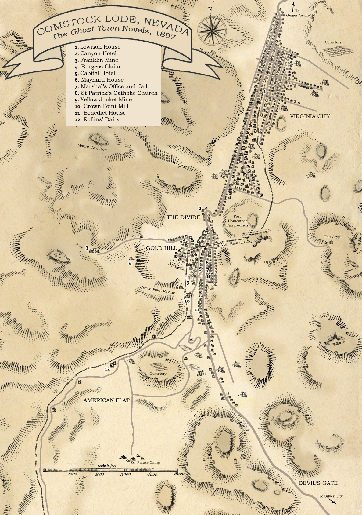
Using my terrain map as a base, and the wonderful brush packs of K. M. Alexander (a godsend to any aspiring cartographer), I finally have my definitive Ghost Town map. This one is an overview that works for all three novels, but I’m planning to make three specific ones for each story, with more detail. (I had to REALLY simplify Virginia City’s street plan to make it fit.)